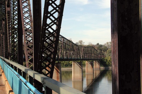
 There’s been some discussion on the phred bike touring list lately about crossing the Mississippi River on the old Chain of Rocks Bridge between Missouri and Illinois.
I rode up the riverfront and across the bridge with Bro Mark in 2004. I’m getting ready to head out of town, so I didn’t have time to pull up my GPS track, but here are some random photos from that ride and some links that might help.
The photo above shows the famous 22-degree bend in the middle of the bridge that was necessary to allow river traffic to have uninterrupted navigation of the river.
St. Louis Arch
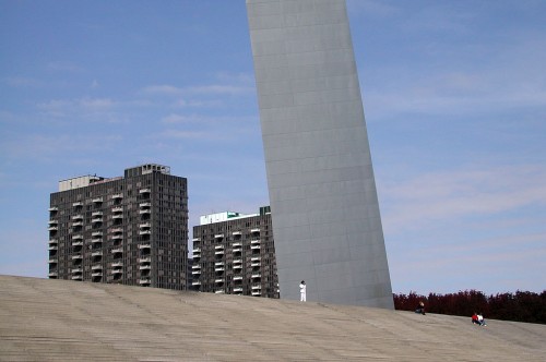 My brother lives directly in front of the Missouri Botanical Gardens. We rode from his house on surface streets past the St. Louis Gateway Arch, the Union Light and Power Company and a ceramic artwork on the side of the Mississippi River floodwall.
Maybe it was because I was with a native who knows the right roads, but it was a much more pleasant experience than I would have expected. In fact, it was much more enjoyable than most of my St. Louis treks by car.
St. Louis Gateway Arch and Mississippi River
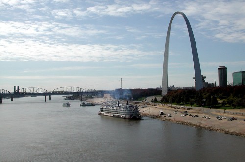 A ride to the top of the arch is a great experience if you’re not claustrophobic. The view is spectacular.
St. Louis is home to classic old buildings
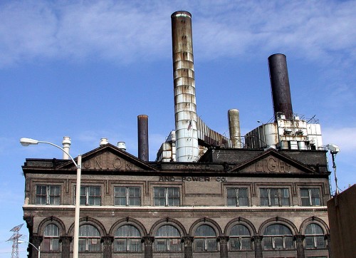 The coal-burning Union Light and Power Company generating plant just north of downtown St. Louis was built in the early 1900s to provide electricity to a growing population. It’s still in use.
When I was a kid, we always thought of St. Louis as a dark and “dirty” town. I realize now it was because many of the homes and businesses burned coal for heat.
The Confluence River Trail
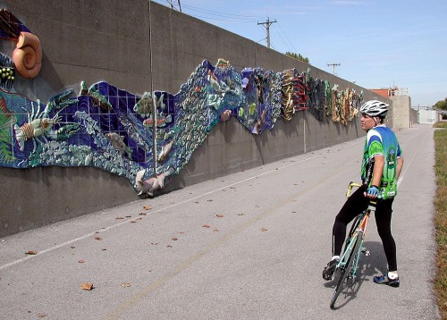 There is a 190-foot ceramic mural depicting the flora and fauna of the Mississippi River on the floodwall. The Confluence Greenway website has a trail map and video of the 11-mile trail that leads from downtown St. Louis to the Chain of Rocks Bridge.
View of Chain of Rocks
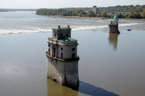 Here’s a view of the Chain of Rocks that caused river traffic so much trouble. I believe that the objects sticking up were water intakes for a water plant that opened in 1894.
James Baughn, a virtual friend of mine, has a website on Historic Bridges of the United States. Warning: do NOT go there unless you are prepared to spend hours jumping from bridge to bridge.
He has an extensive entry on the Chain of Rocks Bridge. One theme that runs through many of the comments is that the bridge is in an isolated area and that burglars prey on cars parked on both sides of the bridge. Two sisters were raped an murdered on the bridge in 1991.
Experienced bicycle tourists are less likely to be victims than unaware pedestrians, but caution is advised.

St. Louis needs to burn coal for heat? I had thought the place exported heat.
Concerning safety issues at the Chain of Rocks Bridge. There have been in the past a rash of cars broken into while riders are off riding the trails. That being said, whenever there is an organized ride there they usually provide security for the parked cars. But to drive there, unload your bike when you might be only one of a handful of cars, there is a good chance you could be the victim of a smash and grab.
Instead, park your car in downtown St. Louis and ride from the Arch to the Chain of Rocks Bridge. The trail from downtown to the bridge is paved and follows the river for most of the trail. An easy ride on flat surface which also includes sightings of deer and turkey when riding on the levee (which is paved) portion of the trail when riding in the early morning or late evening.
A great ride that LOTS of riders take advantage of. You can take it slow and enjoy the sights of the river or you can burn up the path if you want a good workout. About 10 miles from the Arch to the bridge, so the 20 mile trip can be a good easy ride for beginners and families or a great workout if you need bury your head and work on your cadence.
Look for more details on the Confluence Greenway website if you are interested in this ride.
Nice bridge photo. But how did that 22 degree bend allow unrestricted navigation?
Here’s a pretty good explanation:
http://www.rollanet.org/~conorw/cwome/article4.htm
” If the bridge had been built straight, the engineers would have had to choose between two problematic routes. One route would have put the bridge in a location where it couldn’t have been solidly founded on bedrock. The other route would have posed problems to river navigation by not allowing barges to line up with the current, possibly causing them to collide with the bridge. Although this bend was troublesome for motor traffic, it served as a compromise between geological and navigational concerns.”