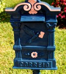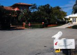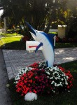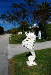
Hypoluxo Island Mailboxes

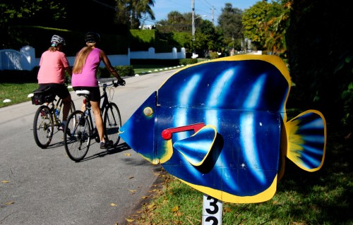
Anne and I decided we’d ride south instead of north for a change the other day and ended up on Hypoluxo Island, which runs north and south from East Ocean Ave. and sticks out into the Intracoastal Waterway.

Map of North Hypoluxo Island


View North Hypoluxo Island in a larger map
I like it because there’s very little traffic and it’s slow-moving. The homes are a curious mix of the 50s, 60s and 70s, with a growing number of high-ticket McMansions popping up.

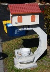
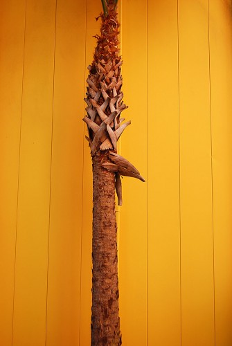
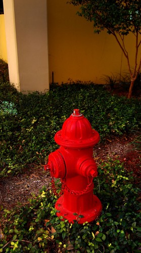
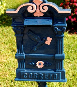
A place of unique mailboxes
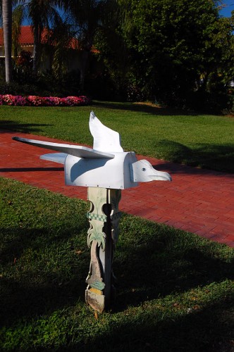
One of my first PalmBeachBikeTours posts was about a neighborhood in Lake Worth, Fl., that had fancy mailboxes. This stretch of North Atlantic Dr. goes beyond that.

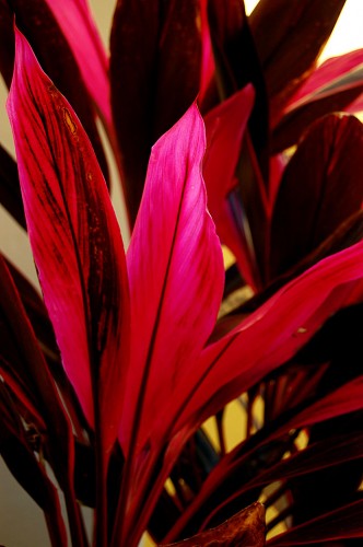
Starburst (Clerodendrum (Clerodendron) Quadriloculare)
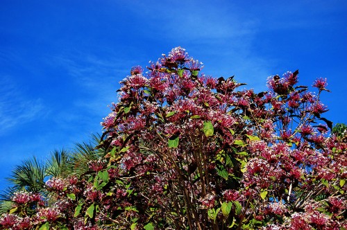
Anne was particularly impressed with flowering shrub. When she asked me what it was, I had to admit that I didn’t have a clue. When Osa joined us on this weekend’s ride, we were lucky enough to spot the owner out in the front yard. He couldn’t remember the name either, so he took off on a run to ask his gardener.

I couldn’t make out the real name, but “Starburst” gave me enough of a clue that I could Google it.

Insisted on taking our picture
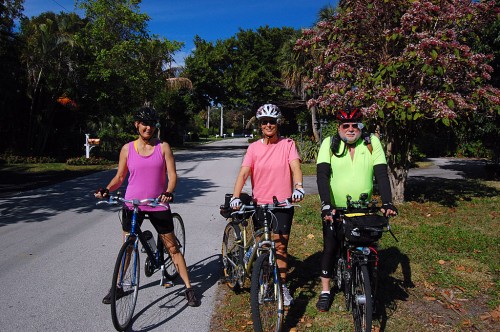
The nice man wouldn’t let us leave until he had taken our picture with my camera. Note how Anne and Osa are smiling. I, on the other hand, am remembering what happened to a photographer I dispatched to a riot. He radioed in that he was arriving at the scene, but then we didn’t hear anything from him. After about an hour, just before I was getting ready to send him backup, he walked in with a sheepish look.
“What the bleep happened to you? We were getting worried.”

“Well, I got there and made some pictures. Then, while I was standing around waiting to see if anything else was going to happen, this kid about about six years old walked up and said, ‘My daddy’s a policeman and he carries a radio just like your radio. Can I see it?’ The next thing all I see is a-hole and elbows as he boogied out of there. I got in a car with a couple of cops and we cruised around trying to find him, but he was long gone.”

Professional photographer advice

“OK, kid, I’m going to give you two pieces of professional advice: (1) NEVER let your equipment out of your grasp and (2), if you do, start out the story with ‘There I was, surrounded by these four thugs that had to be 6’4″ and carrying knives bigger than that….’ NOWHERE should the phrase, ‘six-year-old kid’ come in.”

I felt much better after the nice man handed me my camera back.

Copper or bronze?
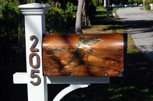
This box looked like it might be copper or bronze.

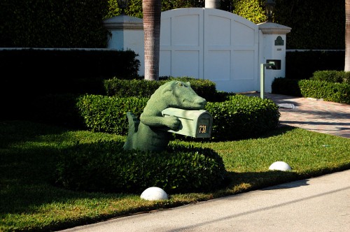
Gators are a popular theme
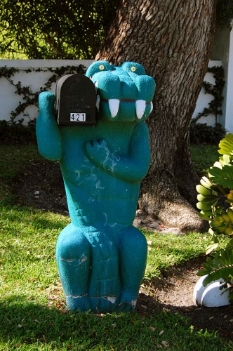
Gallery of Hypoluxo Island mailboxes

Click on any image to make it larger, then click on the left or right side of the photo to move through the gallery.

Dodging Rain in Palm Beach

Osa and I wanted to get in a mid-week ride, so we let the wind decide our direction. It was blowing briskly out of the south, so we headed south, hoping to be blown back home.

When we got down to about Lantana, she felt the first few sprinkles of rain. We stopped, bagged everything up and checked the radar. We had rain to the southwest, west and north, and the temperature was starting to drop. We decided those who fight and run away may live to fight another day, so we turned back. The tailwind, for once, stayed a tailwind.

Pavement wet in Lake Worth

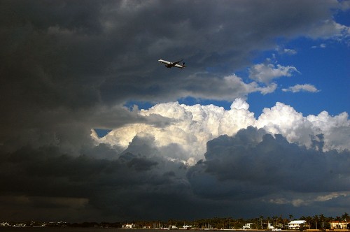
By the time we got to Lake Worth Beach, we notice the pavement was wet, so we had just missed one line of showers. When we made the west turn onto Southern Blvd. from A1A, she thought I might want to stop to shoot an island bathed in light with the dark clouds behind it. I’ve run several photos from that location lately, so I was really just humoring her (you do that when you finally run across a good riding partner) when I pulled out the camera.

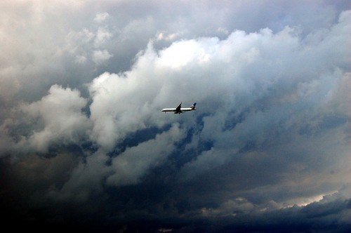
Just then, the sun lit up the clouds and the homes on Palm Beach and a jet on final approach to Palm Beach International Airport popped up. Thanks, Osa. [Click on the photos to make them larger. They’re nicer when you can see more detail. Brag mode off.]

We logged about 16 miles, dodged all the rain and I got a couple of easy photos. Not bad for a January afternoon when other cyclists are talking about the merits of studded bike tires to ride on ice.

Riviera Beach’s Marina Grande

It was a beautiful day Sunday, so I convinced Osa and Anne that we should ride some West Palm Beach neighborhood streets that neither of them had explored. Some of those are much more interesting than the places most riders stick to.

We made it through West Palm Beach to Blue Heron Blvd. and paused at the foot of the Blue Heron Bridge, the closest thing that passes for a mountain in South Florida.

Osa has been fish-sitting for a friend, so she asked if we could swing by the Marina Grande, where her friend lives. I’ve passed by the place many times while riding and on my way to food buddy Jan Norris’ house, but hadn’t been near the grounds since it gobbled up a landmark seafood joint, The Crab Pot.

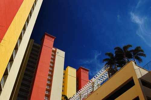
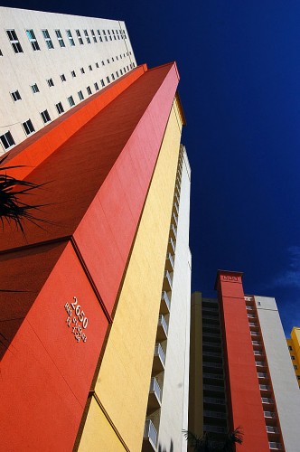
Marina Grande is colorful

When we pulled up to the security guard shack, Osa explained to a very friendly guard that she didn’t have an ID on her because she hadn’t planned on needing it on our bike ride. The guard checked her log, discovered that Osa had been there in the past and waved her on. She said it was OK for us to go through as well.

As I rode past her, I whispered, “You might want to check her water bottle on the way out, there’s a rumor that Osa is a noted fish thief.”

Keeping your bike safe

Osa and Anne went up to feed the fish.

Jim Foreman, one of the phreds, is fond of saying, “One of three things needs to be on your bike at all times: your hand, your butt or a big, strong lock.”

Keeping Jim’s advice in mind, I opted to stay downstairs with the bikes. I was afraid that any place where security was lax enough to let the likes of us through was probably a haven for bike stealers.

That gave me plenty of time to notice how the building’s colors made everything look vibrant.

Even the foliage came alive

There was a picture to be made almost everywhere you turned. Even though Anne came downstairs raving about the saltwater tanks with their exotic fish and flowing soft corals, I didn’t regret hanging out near the building’s dumpsters.

I miss the Crab Pot

The condos are colorful and generate a lot more tax revenue for the city, but I miss the Crab Pot. It was one of those Old Florida institutions that had all kinds of kitsch hanging everywhere, but they sure could sling seafood. I cracked many a crab claw there.

You could eat inside where it was air conditioned (that’s how you could tell residents from tourists) or you could eat outside and toss your scraps over the railing to be scarfed up by fish or diving seagulls.

New Year’s Resolution Riders

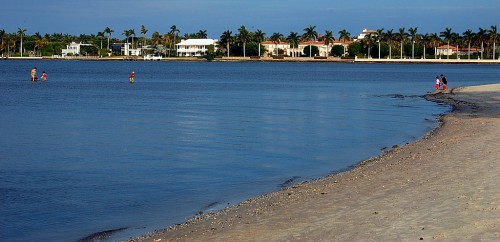
Osa and I went for a January 2 ride this afternoon. Temperatures were great, but we could have done without the headwinds. We stopped on the Southern Blvd. Causeway for a few minutes to let backed-up traffic thin out from a drawbridge opening. While there, I saw this family looking like they were walking on water. The tide was out, so they could walk two or three hundred yards and still be in water about knee-deep. I don’t know what the lake temperature was, but the surf temperature in the ocean was 71 degrees, when the air was 76.

This was a lot more pleasant an experience than when I stood on a fire ant mound on this causeway to take a night photo on one of our rides.

While we were cruising along, we passed lots of what we dubbed “New Year’s Resolution Riders.” They were folks who, obviously, don’t ride on a regular basis, but they were soldiering along because they had made a New Year’s Resolution to get more exercise.

Did I ride on New Year’s Day?

Actually, no. I had good intentions, but Wife Lila mentioned that she’d like to see the sun rise over Lake Worth Beach on the first day of 2011, so we got up at Dark O’Clock and headed out. Here’s a gallery of photos we took.

Click on any photo to make it larger, then click on the left or right side of the image to move through the gallery.

Fourth Annual Chili Cookoff

In the afternoon, we went to Adam and Carly’s Fourth Annual Steinhoff Family Chili Cookoff. You can read all the details at foodie friend Jan Norris’ website.

Cape to Expand Cape LaCroix Trail

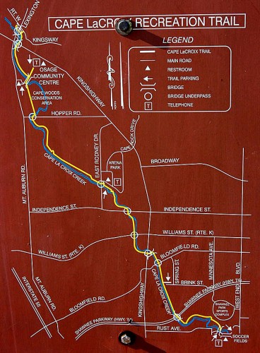
After a series of floods that sent water coursing through a local businesses, Cape Girardeau decided to tame the creeks that were causing all the trouble. One of the side benefits of that was the Cape LaCroix Recreational Trail, a 4.2-mile multi-purpose path created next to the creek.

I wrote back in 2008 how folks from out of town were coming to Cape to ride the trail and causing cash registers to ring. I speculated that it was the most-used non-spectator park in town. I’ve never been on it without meeting tens of bikers, roller bladers, joggers, walkers, families with stroller or people walking dogs. That might make it a little less desirable for hard-charging bike rider, but the town’s definitely getting its money’s worth out of the investment.

Thousands use it every nice weekend

A story in The Southeast Missourian announcing that the trail was going to be extended echoed that sentiment:

Suggest to Brock Davis that Cape La Croix Trail is well-used and he’ll chuckle.

“Well used? That’s not even close,” said Davis, Cape Girardeau’s parks division manager. “You will see people on that trail every single day, whether it’s raining, snowing or whatever. In nice weather, there are thousands of people that use it on a weekend.”

[Editor’s note: The Missourian story spells the name as Cape La Croix (with a space); a sign posted at the Kingsway Drive trailhead has LaCroix as one word, the way I’ve always seen it., so I’m going to stay with that spelling.]

North end extended this fall

When I was in Cape this fall, I noticed new construction on the north end of the trail. I followed it and found it that about two miles of trail had been added north of the Kingsway Drive / Lexington Ave. trailhead. It took it all the way to the North County Park Conservation Center Nature Trail. There, unfortunately, was a sign banning dogs, bicycles and roller bladers on the unpaved walkway.
You can get a feel for what the path looks like on my CapeCentralHigh blog.

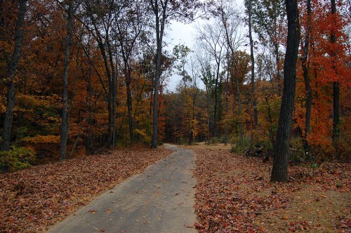
Final paving done

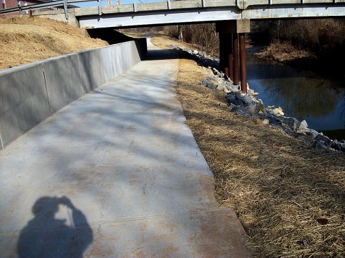
When I was there, one segment under a bridge needed to be paved. My mother shot this photo Dec. 12 showing the whole trail is now  passable.

The neat thing about this is that it ties in a whole new subdivision under construction. It’s not the mileage that’s so important, it’s the fact that it becomes a viable transportation link for a whole bunch of people who will now have an option other than blowing dead dinosaurs out their tailpipes.

New projects stress getting from A to B

I’m excited about the 2,100 feet of new trail that The Missourian mentions in the Dec. 28 story because it shows a shift in thinking from building “bike trails” for recreational uses to building alternative ways to move around the city.

“The project would have two segments to improve the connections between the area along West End Boulevard near the Shawnee Sports Complex and the rest of the city, said Ken Eftink, assistant city manager and director of development services.

It’s not the length of the new trails that will matter, Eftink said, but where it will be located.

The main segment of new 8-foot-wide trail would run along West End Boulevard from Linden Street and extend south to snake through the soccer fields and connect with the pedestrian bridge where the trail currently ends, Eftink said. The second segment will be the connection from the trail to Shawnee Park ball fields near the Southeast Missouri Hospital pavilion, he said.

“The focus of the enhancement grant is really get people from point A to point B,” Eftink said. “Our overall goal is to provide a loop of the city. The trail opens up access to Arena Park, the Aquatics Center, Osage Centre and now up to North County Park,” Eftink said.

Cape has lots of hills

Cape has a rolling terrain with lots of short, steep hills. The bike trail makes it possible for me to go from my mother’s house on the northwest end of the city all the way to the south part of town without having to fight traffic nor constantly climb hills. I can pop out along the way to easily make it downtown for a ride along the Mississippi River or go down to see Civil War Fort D.

I ride the trail when I’m in town not so much for recreation as I do for a convenient way to move around. I’m glad the city is thinking in those terms. It’s a lot easier to justify a transportation link in these days of tight budgets than a recreational trail.